Skynamix Aerial Surveying and Analysis
DJI Inspire 1 Pro X5
Year 2016Similar listings
Other listings from Skynamix Limited
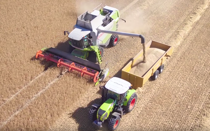
Skynamix provide 2d and 3d aerial mapping. for analysis via your own Agronomy expert or using our own crop health analysis systems. Flying a pre-planned route over your crop, we produce a very high resolution image of the area, which can then be analysed by our own or 3rd party systems.
Region Suffolk, Norfolk, Essex, Cambs, Herts, Beds
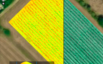